Sunday, October 30, 2016

Travel Tip #48 - Keep an eye out for fun Holiday outings

     I've mentioned before that you don't need to travel far or spend a lot of money to have an enjoyable family outing. There are many fun things to do right in your own backyard. This is especially true during holidays. We've been able to do several fun, cheap activities during various holiday seasons just by checking out what is going on around town. Some of the fun things we've done are: taking a "Halloween cruise" down a small section of the river that is decked out for the holiday; getting apple cider and apple sauce donuts after shooting apple blasters and other fun activities at an apple farm during the harvest; visiting a scarecrow festival; participating in a reenactment of the first Thanksgiving; visiting a Festival of Trees decorated for Christmas; driving through neighborhoods or public centers decked out with fun Christmas lights; exploring ice castles in winter; participating in Easter egg hunts; watching free pageants about Easter; visiting hot air balloon launches, fireworks shows, parades, and reenactments of colonial days for Independence Day. Those are just some of the things we've done.
Walking down the path to our boat for the Halloween Cruise

Visiting the local Ice Castles
     There is a holiday practically every month of the year, which means that there is often something going on locally that you can participate in without putting out much effort or money. We used to get a local newspaper before I realized that their internet site was easily accessible, free, easier to navigate, and didn't stain your fingers black. Ever since I started accessing it daily, I became a lot more up to date on different events going on in the area. Another easy way to find out about things is word of mouth. With all the social media sites, you often see friends' pictures about fun things they're doing. It's easy just to respond and ask details so that you can enjoy that activity too.
     With so many wonderful opportunities out there, take time to smell the roses all around you and enjoy the holiday season!

Sunday, October 23, 2016

Spotlight: Utah County - Alpine Loop

Spotlight: One of the best things about autumn is the fall colors. Everyone knows that New England has beautiful fall colors; but they don't have a monopoly on gorgeous autumn leaves. The aspen groves that dominate the Wasatch Front create some of the most colorful autumn foliage in the nation, with the golden aspens and crimson maple leaves contrasting sharply with the green pine trees. Although there are plenty of gorgeous scenic drives throughout the state, the Alpine Loop is habitually ranked among the top scenic drives in the state - particularly when summer rolls into fall.


Location: Take UT HWY 92 east from the Alpine / Timpanogos Cave National Monument exit #284 off I-15 and follow it all the way to US HWY 189; then head west back to I-15. Or exit #272 off I-15 at 800 North in Orem and take UT 52 east to US 189 to UT 92; follow this all the way back to I-15 in Lehi.

Cost: $6 (3-day recreation pass), $12 (7-day pass), or $45 (annual pass) good for Alpine Loop and Mirror Lake Highway

Time: Plan on about 2 hours if you just drive and stop periodically. Add on any extra time for hiking. The loop is closed during the winter, but opens up near the beginning of May, and stays open until late October.

Description: The Alpine Loop is a 20-mile drive that winds through the canyons of the Wasatch Front from American Fork to Orem/Provo. The drive takes you around Mount Timpanogos - the most popular mountain in the valley - and offers access to many of its natural beauties.


     In addition to beautiful fall foliage, the loop passes by the following popular attractions: Timpanogos Cave National Monument, Timpooneke Trail (to the summit of Mount Timpanogos), Julie Andrews Meadow, Cascade Springs, Silver Lake, Stewart Falls, Aspen Grove, and Sundance Mountain Resort.
Mount Timpanogos hike
Stewart Falls
Rating: 4 1/2 stars (out of 5)

Things You Should Know: - The entire Alpine Loop is paved, and most vehicles can travel its entire length without any difficulty. Vehicles over 30 feet, or older cars that have trouble going up inclines, are not recommended.
- The road is windy, so if you are prone to carsickness, take appropriate precautions.

Nearby: Thanksgiving Point, Bridal Veil Falls, Deer Creek, Heber Valley Railroad

Sunday, October 16, 2016

Spotlight: Utah County - Fifth Water Hot Springs and Waterfalls

Spotlight: Fifth Water Creek is a tributary of the Diamond Fork River. Along this creek are some popular hot springs that have created several luxurious natural soaking pools. The popular hike, often referred to as the "hot pots," is located in Diamond Fork Canyon near Spanish Fork, Utah. The trail also passes several picturesque waterfalls. Although the trail can be accessed year-round with the right kind of vehicle, it is often covered with snow from late fall to early spring. It is extremely popular on weekends during warm weather.

Location: Fifth Water Hot Springs are located along Fifth Water Creek. To get there, travel up Highway 6 through Spanish Fork Canyon until you reach the Diamond Fork Turnoff (about 11 miles east of Spanish Fork). Travel north up Diamond Fork Canyon for about 9 1/2 miles to the Three Forks Trailhead. Go through the gate, and do not cross the first bridge! Instead hike along the trail on the north side of the river until you reach a second bridge (about a mile up the trail). Cross this one and follow the trail another mile or so until you reach the hot springs. There is a fork in the trail before the springs, but they merge again further up, so it doesn't matter which one you take.
Cost: Free

Time: The hike will take about 2 hours round trip. Add on the amount of time you want to spend exploring the waterfalls or bathing in the hot springs.

Description: The Hot Springs at Fifth water are a series of pools that have been diverted and walled in to create several naturally fueled hot tubs that are perfect size for sitting. Although the smell of sulfur can be strong, the water itself is very clear. The temperature will vary from pool to pool, and even from one area of the pool to another, so always check the temperature before bathing.


     In addition to the hot tubs, there are four waterfalls along the trail. The lower falls are just up from the first set of pools. It is a unique waterfall in the sense that there is a small cave at the base, and another higher up. During the spring, you can feel cold water falling down from the spring runoff, while squatting in the heated water below. The upper cave has a window that you can peer out through at the water cascading down. If you go later in the year, you will get a much different look.
sitting in lower cave (early June)
Looking out window of upper cave (June)
Upper window (late August)
Lower cave (August)
      Above the first waterfall, there are two more hot spring pools, followed by the second waterfall. This one is also very photogenic. The third and fourth waterfalls are a ways higher up the trail. They are nice cascades, but not as cool as the first two, and are less accessible.
2nd waterfall

3rd waterfall
4th waterfall
Rating: 4 1/2 stars (out of 5)

Things You Should Know: - The road up Diamond Fork Canyon is windy and narrow in parts. You will also occasionally encounter cows in the road; so drive carefully.
- Parking at the trailhead can get pretty crowded on weekends, so get there early.
- The first time we went looking for the hot springs, we crossed the bridge. It was a pretty hike, but we didn't find any hot springs. Instead, hike along the river until you reach the second bridge.
- The hot springs often attract skinny-dippers (particularly in the evenings), so you might want to be cautious - especially with children in tow.
- Hikers occasionally see rattlesnakes along the trail during the warmer months, so have an experienced hiker take the lead.
- The trail is also popular for bicycles.
- I would strongly recommend bringing rubber-soled water socks or shoes that you don't mind getting wet while walking in the stream or pools. My niece cut up her feet trying to walk barefoot. Also, the rocks are extremely slippery from the white and green moss that collects on them from the water; so use extreme caution.
-  Although the water is mostly clear, you will see small black ash particles floating in some of the pools, so be careful about getting water in your mouth or eyes.
- The waterfalls are best in the spring when there is a lot of spring runoff.
- There are plenty of camping spots in the canyon if you want to spend a couple of days enjoying the beauty of nature.

Nearby: Red Ledges Picnic area, Spanish Fork Peak, Scofield State Park, The Grotto

Saturday, October 8, 2016

Spotlight: Utah County - Cornbelly's Fall Festival and Corn Maze

Spotlight: This week's spotlight is a festival. Cornbelly's is an annual Halloween/Fall harvest celebration that takes place at Thanksgiving Point every October. Cornbelly's is famous for it's MAiZE, which first began in 1996 as the dream child of Brett Herbst. The MAiZE has grown into the worlds largest cornfield maze company, winning a Guinness World Record in 1999. However, Cornbelly's is more than just a giant corn maze. There are a plethora of activities and events for both kids and adults.

Location: Cornbelly's takes place at Thanksgiving Point in Lehi, UT.

Cost: There are different passes you can buy, each one allowing you admittance to more attractions than the previous one: General Admission (ages 3-99; ages 2 and under are free):
Laughn' - $11.95/person (Mon.-Thurs.); $14.95/person (Fri.-Sat.)
Screamn' - $24.95/person
Lovin' - $26.95/person

Time: Plan to be there 2-6 hours. This year, the festival started Friday 9/30 and will go to Saturday 10/29. It is open from 10:00 am - 11:00 pm (Fri. & Sat.) and open 4:00 pm - 9:00 pm (Mon.-Thurs.) with extended hours (10-9) on Thurs. 10/20 and Mon. 10/24.

Description: The main attraction is the MAiZE. Each year, has a different theme. This year's theme (2016) is the Peanuts Gang. Visitors are supposed to find various checkpoints before finding their way back to the entrance/exit. There are several other smaller mazes geared toward various ages. Separate from the corn maze is the Grain Train Maze. A tractor leads a train of cars on a ride through the maze to see various scarecrow and jack-o-lantern displays.
Grain Train Maze
Beatles Jack-o-lantern
     Other regular admission (Laughn') attractions include: Animal Band, Barnyard Ball Zone, Barnyard Billiards, Barnyard Soccer, Campfires, Corn Ball, Corn Cob Beach, Corn Hole, Corn MazeCornbelly Mountain, Cow Train, Duck Races, Farm Golf, Farmer Fast Pitch, Farmn' Foosball, Giant Rat Maze, Giant Slide, Grain Train, Haybale Maze, Hayride, Jumbo Jumpers, Kiddie Courtyard, Pumpkin Bowling, Pumpkin Princess Playland, Pumpkin Tetherball, Pumpkin Tic-Tac-Toe & Checkers, Rat Rollers, Singing Chicken Show, Special Events, Spiderwebs, Spookley Show, and Steer Roping.
Farmn' Foosball
pumpkin bowling

Corn Cob Beach
Duck Races
     The Screamn' Pass includes all Laughn' Pass attractions, plus entrance to the following Insanity Point attractions: Big Top Terror, Chaos Castle, Creature, Hayloft Horror, and the Haunted Maze.
The Creature at Insanity Point
     The Lovin' Ultimate Combo Pass includes all of the Laughin' and Screamn' attractions plus: Rockwall or Cole's Corral; Paintball or Apple Blasters; Hot Cocoa or Shaved Ice; Bull Riding or gemstone or cookies; and zipline or kettle corn or caramel apple.

Rating: 4 stars (out of 5)

Things You Should Know: - Cornbelly's is open for extended hours during Fall Break.
- The Corn Maze may be closed due to bad weather. Check website for closures.
- Special events this year include: Outdoor Movie Night (10/10), Meet the Gang Mondays (Peanuts characters), West Coast Lumberjacks (10/14-10/17), High-flying Trick Dog Show (10/19-10/26), Munchkin Radio Dance Party (every Sat. 11-3), Trick-or-Treat Parade (every Sat at 2:00), storytelling (daily), pig races (daily), Scary Tales n S'mores (Mon., Fri., Sat. 7:00 pm), Wild Wonders (Tues-Thurs), Magic Mondays (5:30 & 6:45), Candy Cannon (Mon, Fri, Sat), Fireworks (Fri & Sat), Pumpkin Smash (10/29)
Candy Cannon
- Thanksgiving Point members receive a 25% discount on Cornbelly's ticket purchases.
- If you purchase your tickets online from the website, you receive a $2 discount/ticket; but you also pay a small service fee. Overall, you come out ahead, and you don't have to stand in line.
- If you don't see everything on your first visit, you can purchase bounce-back tickets for later in the season.
- Most of the activities on the Laughn' Pass are geared toward younger kids (ages 3-10).
- Insanity Point attractions are only open after dark on select dates. Check the Calendar for times.
- Insanity Point screamn' attractions are open to visitors during the daytime, but they are "unhaunted" for a less spooky diversion.
- If you only wish to do one or two of the "Lovin' Combo Pass" activities, you can purchase items separately at the ticket booths, but you miss out on the discounts.
- Cornbelly's has a wide selection of pumpkins for sale, ranging from $0.50 - $10. Pumpkins are available in a wide variety of shapes and colors, from classic orange pumpkins to deranged white ones. You don't need to enter the event to purchase pumpkins.

Nearby: Museum of Ancient Life, Farm Country, Megaplex Theatres, Museum of Curiosity, Thanksgiving Point Gardens, Thanksgiving Point Golf Course,

Sunday, October 2, 2016

Spotlight: Utah Peaks - Spanish Fork Peak (aka Maple Mountain)

Spotlight: Spanish Fork Peak, or as it's known in Mapleton - Maple Mountain, is one of the "Seven Peaks" that surround Utah County. Although there are more than 7 peaks higher than 10,000 feet in Utah County, a view of the Wasatch Mountains from Utah Lake has seven distinct groups of mountains that jut up into the sky from the valley floor. The Seven Peaks are the seven most prominent mountains in each group. At 10,192 feet, Spanish Fork Peak is the shortest of the seven. That doesn't make it the easiest to conquer.

Location: The trail head is located up Mapleton Canyon. Drive east on 400 N until you reach Whitings campground. The sign says it is a fee area, but that is for the campground. Keep going up that road until you pass the campground and park in the parking lot at the end of the road. Start hiking up the Left Fork Maple Canyon Trail for about a quarter mile until you reach the trail head. At this point, the trail you've been following keeps going, but you will cross the stream over a small wooden bridge at the following GPS coordinates: 40.135327, -111.523185

Time: 6-10 hours. My friend and I, who are experienced hikers, did it in just under 8 hours with about a 20 minute break at the top.

Cost: The only cost is physical.

Description: The trail is officially listed at 10.25 miles round trip, but if you count the quarter mile hike to reach the trail head, it is closer to 11 miles. It is a strenuous hike, along a steep trail, particularly the last mile to the top. It is a great workout for experienced hikers, but I wouldn't recommend it for novice hikers.
     The first part of the trail isn't very steep, but it is rocky. Soon after crossing the stream, the trail gets steeper as you steadily climb up through the very lush, green foliage that lines the trail. Although the trail is very distinct, it is not very well maintained. Branches from bushes on either side of the trail often hang over the trail, and several trees have fallen over the trail at various points. We went in mid-June, and started at about 6 am, so our pants got soaked on the way up from walking through the dew-laden branches. Although most of this area is 
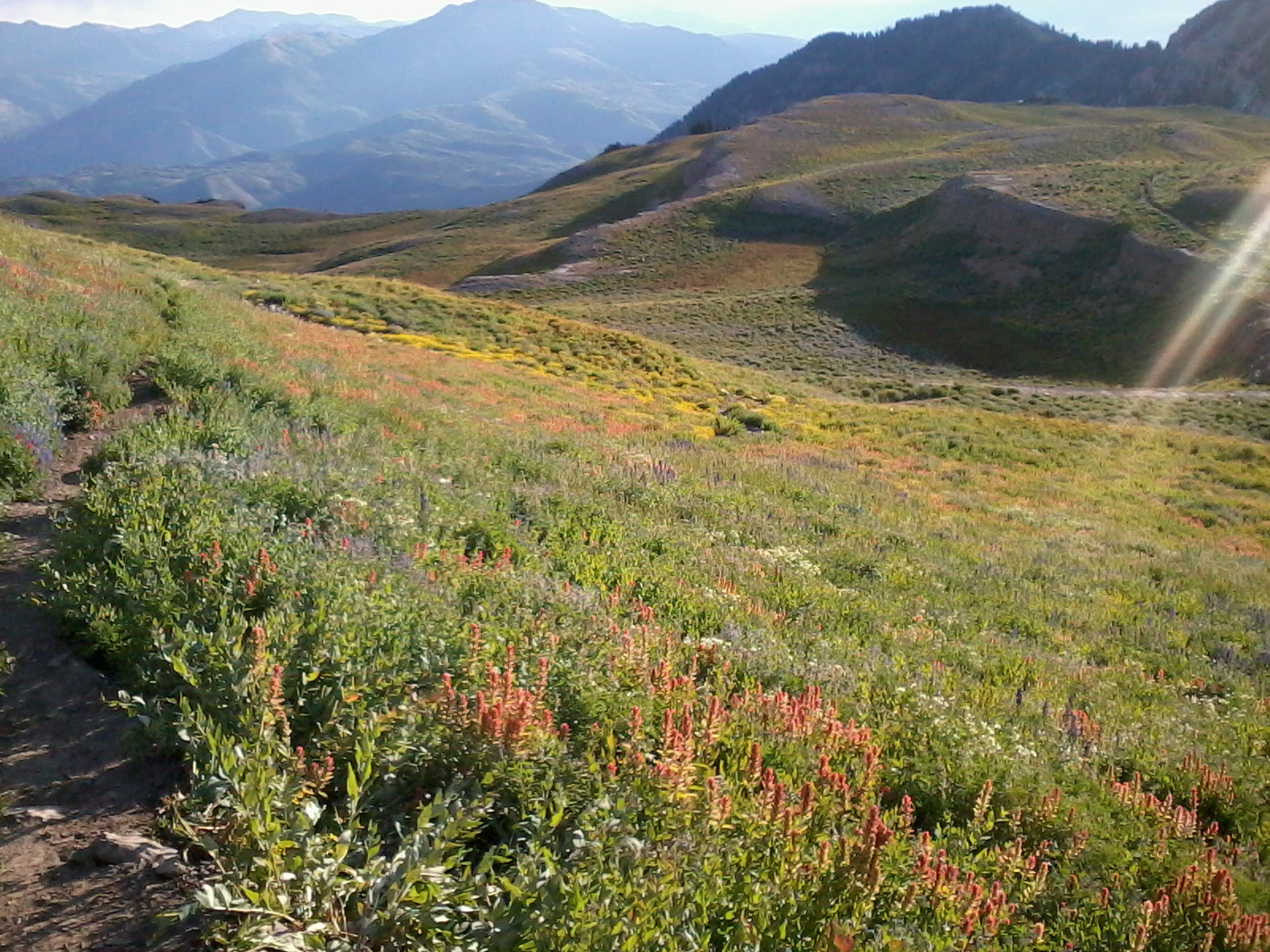
forested, you will intermittently cross through meadows, some of which may contain the occasional camper.
     Eventually, the trail levels out on a plateau that contains several larger meadows, including the one containing Maple Canyon Lake. The "lake" is more of a pond, and is infested with mosquitoes during the summer months.
     Shortly after passing the lake, the trail gets really steep as you press on to the summit. Depending on the time of year, you will encounter snow patches that cover the trail at several points. We had to traverse a large snow field in the bowl that leads up to the saddle, which slowed our progress immensely going up, but made it faster coming down.
     Once you reach the ridgeline, you can see Utah Valley below you. To reach the summit, turn left. From there, the trail will split again. The main trail traverses the western face up the mountain before joining the ridge trail again. It makes a more gradual ascent to the top, but might be covered in snow. Since we encountered a lot of snow, we decided to follow the less obvious ridge trail to the top. It is a little steeper, and makes you lose some of your elevation before climbing again, but was faster since we didn't have to walk across the snow.
     Once you reach the summit, you will find a large rock cairn that contains a mailbox. There used to be a summit log inside it, but someone ripped out the pages. In any case, it offered beautiful views of the entire valley on both sides of the mountain.

View of Mt. Nebo
View of Utah Lake
     To get back down, follow the same trail. Because of the loose rocks, the trip down can be slippery, so take it slow.

Rating: 3 stars (out of 5)

Things You Should Know: - The trail crosses a seasonal creek at one section, so you may get your feet wet. My shoes were soaked from the underbrush even though I was able to cross the creek on rocks.
- If you like geocaching, there are several geocaches along the trail. Some are easy to find, other are a bit more difficult.
- Depending on the time of year, some of the meadows may be filled with beautiful wildflowers.
- You will probably be sore the day after going on this hike, so plan accordingly.
- Recommended items for this hike are: good hiking shoes, sun block, bug spray, a walking stick, snacks, and plenty of water for each hiker.
- Water from the lake must be purified.

Nearby: Mount Timpanogos, Santaquin Peak, BYU, Diamond Fork Canyon.